
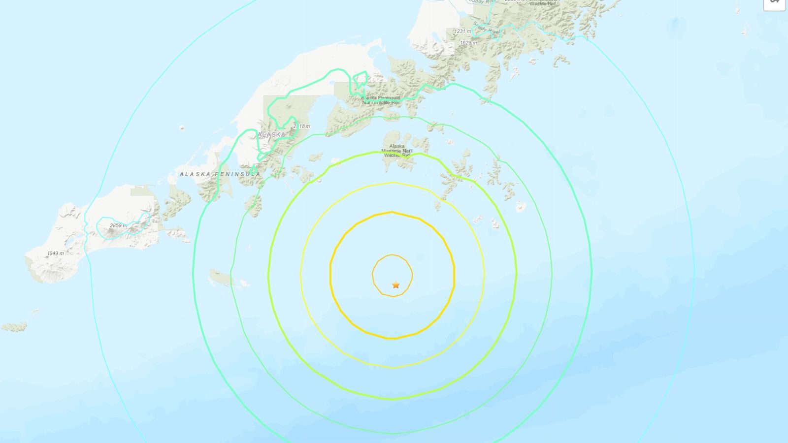
On Sunday, July 16, 2023, a strong earthquake estimating 7.2 on the Richter scale struck the Alaska Peninsula region, triggering a tsunami warning for neighboring regions. The United States Geological Survey (USGS) initially reported the quake as a 7.4 magnitude but later revised it to 7.2. it fortunately did not result in any immediate reports of casualties or critical harm.

Also Read: South Korea Floods: At Least 26 Dead and Over 1000 Evacuated
Sources Related to Alaska Peninsula Region (For R&D)
- Alaska Peninsula in Alaska’s Southwest Region
- Everything you need to know about Alaska Peninsula
- Alaska Peninsula Ranges
- Earthquakes and Volcanoes along Alaska Peninsula
Earthquake and Tsunami Warning in Alaska Peninsula Region
The earthquake happened at around 10:48 p.m. nearby time, with its epicenter situated around 55 miles southwest of Sand Point, Alaska. The USGS recorded the quake at a depth of 32.6 kilometers (20.3 miles), revising the initial depth of 9.3 kilometers (5.78 miles).
The earthquakes were broadly felt across the Alaskan Peninsula, the Aleutian Islands, and the Cook Inlet regions. While earthquakes are somewhat normal around here because of its area along the seismically active Pacific Ring of Fire, only those above a magnitude of four or five tend to cause significant damage.
Also Read: The Ocean is Changing to Color Green due to Climate Change
Following the earthquake, the US Tsunami Warning System issued a warning for nearby regions, including South Alaska, the Alaska Peninsula, and region of the Pacific in close proximity to the earthquake. The warning indicated that widespread flooding was imminent or expected due to the potential tsunami.
The warning was subsequently downgraded to a tsunami advisory, which indicated that strong currents or dangerous waves were expected, imminent, or occurring. Eventually, the advisory was canceled, relieving the potential threat of a tsunami.
Local authorities urged residents in coastal areas to seek higher ground and follow evacuation procedures during the initial tsunami warning. In Kodiak, Alaska, alarms were enacted to caution occupants of the expected tsunami, telling them to look for cover. Luckily, the cancellation of the advisory allowed people to return to their homes without further concern.
Also Read: Cerberus Heatwave: Record-Breaking Temperatures Across Southern Europe
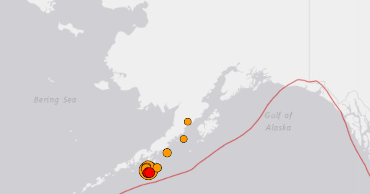
The USGS detailed a few post-quake tremors in similar district, including one estimating 5.0 magnitude in the span of three minutes of the initial earthquake. These delayed repercussions are normal events following a critical seismic event and are firmly observed by experts to survey any expected dangers.
The Alaska is situated along the Pacific Ring of Fire, a district known for its high seismic activity because of tectonic plate movements. This earthquake fills in as a sign of the district’s weakness to quakes and related hazards, like tsunamis.
The most powerful earthquake ever recorded in North America was the 9.2 magnitude earthquake that struck Alaska in March 1964. It caused extensive devastation in Anchorage and triggered a devastating tsunami that affected the Gulf of Alaska, the U.S. West Coast, and Hawaii. The 1964 earthquake resulted in the loss of more than 250 lives.
Also Read: Iceland Volcanic Eruption Close to the Capital City Reykjavik


+ There are no comments
Add yours